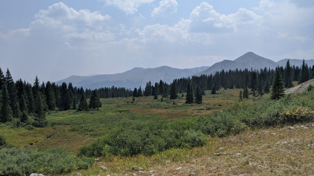
From the Lost Lake Trailhead its a short hike up to the valley view. The trail is mostly dirt, with some roots emerging across the forest area by the road. There are several areas up here that would make a good ceremony site and this one is one of the closest to the parking area. When you look down the valley Jones Mountain North is on the right side and Gladstone Ridge is on the left. Co Rd 306 is an easy winding drive up from Buena Vista and the parking is all on the roadside. As far as roadside parking goes, there’s a lot of it on both sides of the road. Cottonwood Pass is typically closed from November through May depending on snowfall and this site will be equally inaccessible. There are no restrooms here or nearby so plan in advance for that. The trees up here are sparse which allows for some views down the valley. There are no trail markers so if you’re on the shoulder season (June or October) a small bit of snowfall may obscure the trail. Cottonwood Pass is a short drive up the road if you wanted to get some mountain top couples photos.
Lost Lake Trailhead – Valley View

GOOGLE MAP
GEOGRAPHY
- Location Name: Lost Lake Trailhead
- Site Name: Valley View
- Address: Cottonwood Pass, Tincup, CO
- County: Chaffee
- Elevation: 11696 ft.
- Nearest City: Buena Vista
- Location Type: Trailhead
- Site Type: Field
- Background: Mountain Overlook, Meadow
- Features: Lake, Forest, Meadow, Hiking Trail
ACCESSIBILITY
- Max Guests: 16
- Parking Capacity: 10+ Cars
- Road Type: Asphault Road
- Path Type: Uneven Dirt Path
- Walk Duration: 2-5 Minute Walk
- Location Privacy: 6-10 Visitors
- Site Privacy: 3-5 Passerbys
- Pet Access: Leashed Pets
- Availability: June, July, August, September, October
AMENITIES
- Seating: No Seating
- Lodging: No Lodging
- Restrooms: No Restrooms
- Electricity: No Electricity
- Cell Service: No Service
- WiFi Access: No WiFi
- Shower/Footwash: Trailhead
PERMITTING
- Event Permitting: Event: Unknown Permitting
- Pro Permitting: Pro Permit: Unknown
AVAILABILITY
- Months Open: June, July, August, September, October
- Last Visited: August 24, 2020
- Last Updated: January 9, 2022
Links for Lost Lake Trailhead – Valley View
- USFS Pike & San Isabel National Forest
- US Forest Ranger
- 719-486-0749
- Unknown Email
- Leave No Trace
- Fire Prevention
- Google Map - Location
- Google Map - Site
- Google Earth
- Weather
- Altitude Sickness
